A Statewide GPS/AI Monitoring System for Liquid Manure Application
Introduction and Rationale
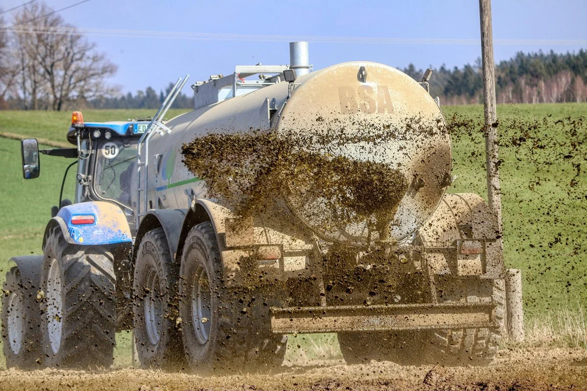
Liquid manure is a valuable agricultural nutrient source when applied correctly, but mismanagement can lead to environmental harm, including nutrient runoff, soil saturation, and water quality degradation. Private trucking and logistics companies have refined GPS/AI fleet monitoring systems that track vehicle location, operating status, delivery times, and compliance with routing rules. A similar technology could be adapted to a statewide public monitoring system to oversee the application of liquid manure by tank trucks serving CAFOs, ensuring applications exactly match state laws and individual nutrient management plans (NMPs).
The goal of such a system would be:
- Promote precision and compliance in manure spreading.
- Increased transparency for the public and regulators.
- Provide real-time alerts and warnings for operators and overseers.
- Support environmental protection and agricultural productivity.
System Architecture and Core Components
The proposed system consists of four integrated layers:
1. Vehicle/Aerial hardware
2. Centralized Cloud Platform
3. Real-time AI and Geofencing Modules
4. Public/Third-party user interfaces
—–—————————————————-
1. Vehicle and Driver Equipment
Each manure application truck— referred to here as a “manure spreader truck”― would be equipped with:
A. GPS/Telematics Unit
A rugged, vehicle grade GPS and telematics device that:
- Tracks real-time location, speed, heading, and stop/start events
- Integrates with vehicle sensors (tank valve status, flow meters, boom position)
- Sends data at regular intervals (e.g. 1-5 seconds)
B. Spread Rate and Valve Sensors
To ensure application precision:
- Flow meters measure how much manure is spread per acre
- Valve/nozzle sensors detect whether valves are open and the rate of discharge
- Onboard weight or tank level sensors confirm load quantities
C. Onboard AI and Mapping Module
An in-cab computing device that:
- Stores the CAFO’s nutrient management plan (NMP)
- Uses AI geofencing to assess if vehicle’s current location and operation match authorized fields and schedules
- Communicates warnings to the driver interface if deviations occur
D. Driver Interface
A touchscreen display or tablet that:
- Guides drivers through scheduled application routes
- Shows “go/no go” status based on weather, soil conditions, and NMP constraints
- Provides instant warnings or audio alerts if operations are unauthorized
All hardware would use secure nationwide cellular coverage and local storage redundancy in case of conductivity gaps.
—————————————
2. Statewide Central Cloud Platform
A centralized cloud infrastructure, managed by the state’s agricultural or environmental agency, would:
Store and Manage:
- CAFO nutrient management plans
- Legal spreading windows (including weather and soil moisture constraints)
- Approved field boundaries (digital maps)
- Truck registry and equipment logs
Process and analyze:
- Real-time location streams from every truck
- AI and analytics comparing activity to NMP constraints
- Historical records for audits and reporting
Compliance Logic
The platform’s AI logic would confirm that:
- The truck is in an approved field polygon
- The time and date fall within the CAFO’s permitted window
- The spreading rate matches the NMP prescription
- Environmental constraints (e.g., recent rainfall) are satisfied
Violations trigger automated responses across system layers.
————————————
3. Real-time Monitoring, Alerts and Warnings
Geofencing and Dynamic Rules
Using digital maps, each legal spreading area is geofenced:
- If the truck enters a non-approved area, the system registers and alerts
- If the valve opens outside of an approved field/time, it logs a compliance violation
Driver Alerts
AI detects violations and WARNS the driver through:
- Visual alerts on their touchscreen
- Audible warnings
- Action prompts (stop spread, reposition truck, contact supervisor)
Observer Alerts
Interested parties—farmers, regulators, watershed groups—can sign up for real-time alerts through:
- Web dashboards
- Text or app notifications
- Email
Example of alert triggers:
- “Truck 723 has begun spreading outside approved field”
- “Manure applied at a rate exceeding NMP specification”
- “Application started before approved window opens”
————————————-
4. Customizing Schedules and Plans
Each CAFO‘s NMP has unique constraints:
- Field boundaries
- Allowed spreading windows
- Maximum application rates
- Soil/weather conditions
These are digitized and uploaded to the Cloud:
- Geographic Information System (GIS) mapping tools create precise field polygons
- State regulators verify and certify upload accuracy
- Application schedules are tied to weather forecast and soil moisture data
AI in the Cloud then:
- Opens time-windows dynamically when conditions are suitable
- Sends approved routes to the driver’s in-cab system
- Locks out spreading when conditions violate plan or law
——————————
5. Transparency and Third-Party Access
The value of this system is not just compliance—it is public transparency. However, privacy and security would be protected through predetermined levels of access ( i.e, farmers, regulators, watershed groups).
Role-Based Access
Stakeholders can subscribe at different levels:
- Public Dashboard: aggregated statistics (not specific truck IDs)
- Certified Observers: Field-specific data during active spreading
- Regulators: full real-time and historical logs
APIs (Application programming interface) and Data Sharing
Open APIs allow:
- Watershed groups to display alerts
- Researchers to study spreading patterns
- Public reports on statewide trends
Data access is governed by privacy policies and law.
___________________
6. Alerts for Improper Spreading
AI triggers warnings at multiple levels:
Immediate Driver-Level Alerts
- “ Unauthorized spread rate”
- “ Field boundary exit detected while spreading”
- “ Schedule window closed”
Observer Notifications
Subscribed observers receive:
- Push notifications (short, pop-up automated messages)
- SMS alerts (short message service)
- Email summaries
Regulatory Escalation
Severe or repeated violations automatically:
- Flag for enforcement review
- Generate audit reports
- Notify CAFO managers
____________________
Cost Estimate: Building and Operating the System for 1000 Trucks
The following approximations are based on industry fleet Telematic standards. Cost may vary by vendor, scale, negotiation, and integration complexity.
Vehicle Hardware
- GPS/telematics unit: $300-$500 per truck
- Flow/Valve sensors and mounts: $400-$800 per truck
- Onboard computing and display: $800-$1,000 per truck
- Installation and calibration: $300-$600 per truck
Per truck estimate total: $1,800-$3,100
Fleet total (1,000 trucks): $1.8M-$3.1M
Software and Cloud Platform
- System design and integration: $500K-$1M
- AI rule engine development: $300K-$600K
- GIS mapping and plan upload tools: $200K-$400K
- Security, API, dashboards: $300K-$500K
Platform build total: $1.3M-$2.5M
Annual Recurring Costs
- Cloud hosting and data plans: $200K-$350K
- Cellular data (1,000 units): $120K-$240K
- Maintenance and support: $300K-$500K
- System upgrades and AI refinements: $200K-$400K
Annual operating total:~ $820K-$1.49M
Summary of Costs
Category Approximate cost
Fleet equipment (capex). $1.8M-$3.1M
Software and platform build. $1.3M-$2.5M
First year total $3.1M-$5.6M
Recurring annual (years 2+) $0.82M-$1.49M
These rough estimates show a system that is expensive but scalable, and likely more cost-effective than manual inspections alone. Also, these are estimates created for a “from scratch” design. In reality, these systems already exist and offer these services at competitive rates.
Conclusion
A statewide GPS/AI manure monitoring system―modeled after private trucking fleet systems―could dramatically improve compliance with nutrient management plans, reduce environmental risk, and enable unprecedented transparency. By equipping trucks with: GPS, sensors, and on board AI; centralizing data in a Cloud platform; and providing real-time alerts to drivers and observers, the state could ensure that liquid manure is only applied where, when, and how it should be. The initial costs are significant; the long-term gains in environmental protection, regulatory efficiency, and community trust justify the investment.
This article was created with AI by the direction of Paul Leline, Secretary